Case study of using full spherical 360° images in Agisoft Metashape
Author: Christiane Zhao, Marketing Specialist
Organisations involved: Agisoft, Weiss AG
Hardware used: Civetta 360° (Weiss AG), Phantom 3 Professional (DJI)
Software used: Metashape (Agisoft), CivettaUtility (Weiss AG)
Creating point clouds, textured meshed models and orthophotos with Weiss AG Civetta -230 megapixels 360° HDR camera
Introduction
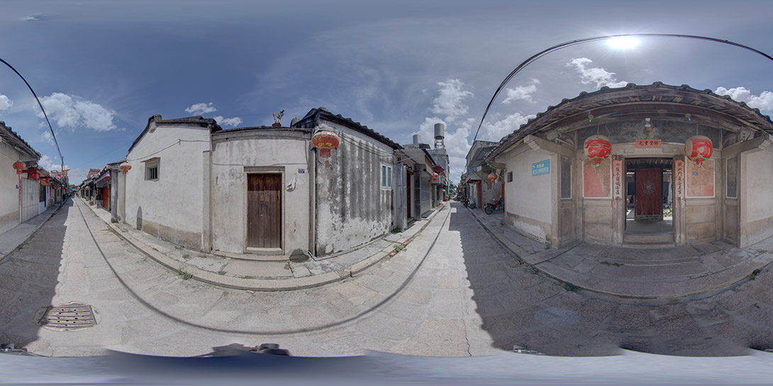
The Civetta is an automated 360° HDR (High Dynamic Range) capturing system, that produces 360° x 180° images with 230 megapixels resolution and a 32 bit (HDR) colour depth, making it the perfect tool for photogrammetry and 3D reconstruction applications. The Civetta is used across a wide range of industries and organisations to capture high precision calibrated 360° full-spherical images.
Developed by Weiss AG in Germany now available in the 5th version, Civettas all around the world are in daily use at clients like Shell, ATF, BP, Guardia civil, FBI, Nvidia, BMW and many more.
The system was designed to be absolutely reliable in also extreme environmental and light conditions.
The power of working with calibrated 360° images from the Civetta is that the location is captured once and can be converted to 6 different results:
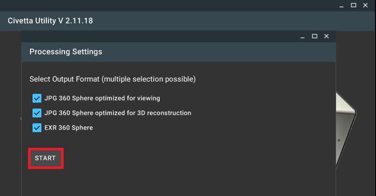
Process with the CivettaUtility software:
- Capture HDR images with 230 MPixel and 32 bit colour depth
- Perform tonal compression to cover the light and the dark areas in one 8bit image
- Take measurements in m or ft in 360° stereo pairs without further calibration
Process with the Metashape software:
- Create coloured point clouds (8 bit, 32 bit)
- Create textured 3D models (8bit, 32 bit)
- Create orthophotos (8bit, 32 bit)
The excellent image quality and the prior calibration make the output of the Civetta the perfect basis for 3D reconstruction.
The aim of this report is to use HDR panorama images from this high precision camera, and process them with Agisoft Metashape to create a measurable 3D point cloud for documentation and reconstruction. This study shows that the Civetta is one of the most accurate and simple capturing devices to use for highly automated point cloud generation.
Content
01. Background
02. Tools used/Software used
03. Our tasks
04. Building/region
05. Challenges
06. Photo capture
07. Camera settings
08. Hour worked: Field hour/ office hours
09. General workflow
10. Deliverable
11. Conclusion
12. Acknowledgement
01. Background
This study aims to showcase and analyze Civetta’s standardized workflow to achieve a high-quality digital twin production in combination with Agisoft Metashape.
The Civetta automatically records a 230 MPixel HDR 360° within 40 seconds, with a focus area of 0.3 m / 1 ft to infinity. Agisoft were the first software developer who integrated the reconstruction functionality from 360° images in their software, based on the Civetta images provided by Weiss AG. The combination of Civetta with Metashape can provide accurate and reliable 3D point clouds for clients in oil & gas, aviation, cultural heritage, entertainment, e-training, law enforcement and more.
02. Tools / Software used
Hardware: Civetta from Weiss AG, DJI Phantom 3 Professional
Software: CivettaUtility (comes with the purchase of Civetta), Agisoft Metashape 2020
Install Agisoft Metashape : Agisoft installer
03. Our tasks
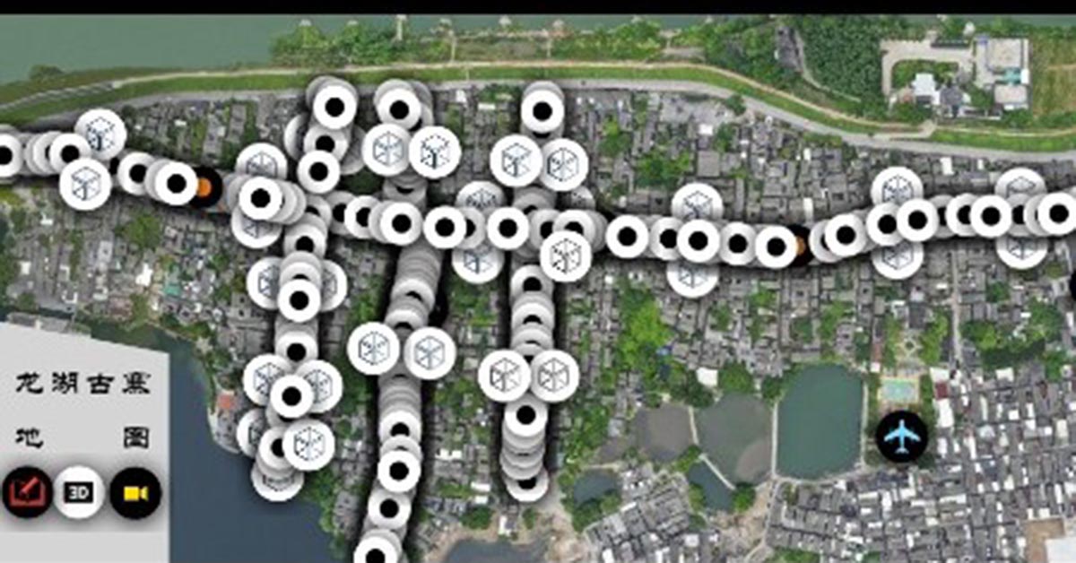
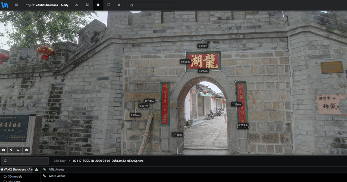
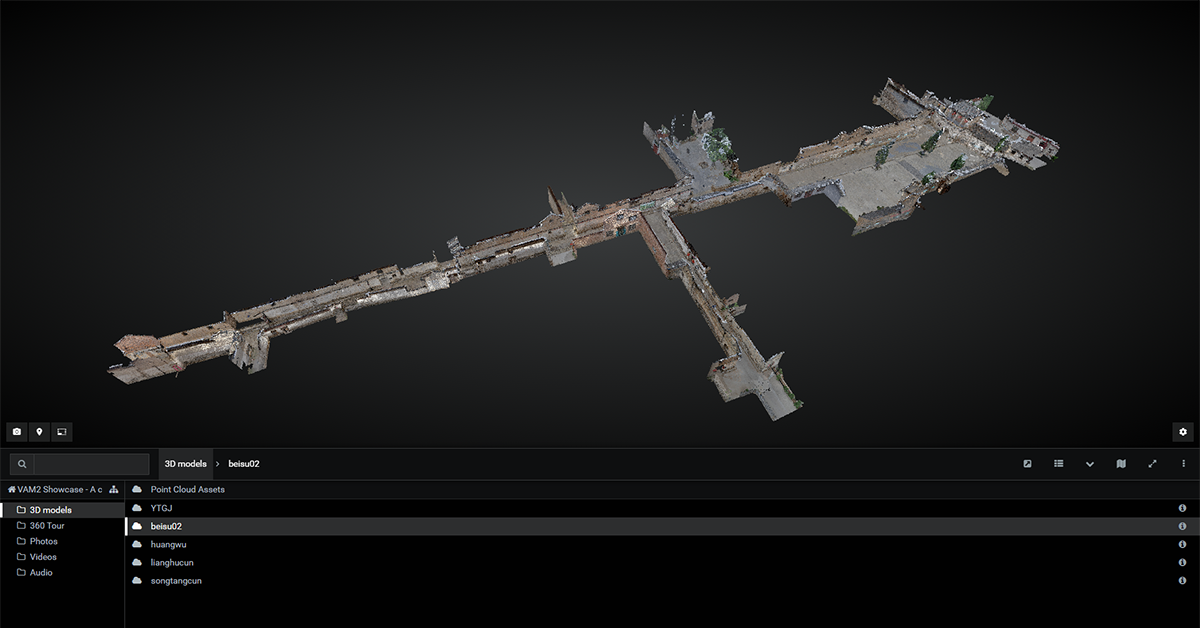
A long-term user of Weiss AG technologies has been hired to record a district of a rural area. The 3D point clouds and HDR panorama images were then used for different departments in the documentation, construction planning, urban planning and digital reconstruction. The 360° image pairs and the 3D point cloud are provided on VAM2, a web-platform to enable the end-user to investigate and take measurements of streets, doors, windows, walls and other relevant objects in the scene.
04. Building / region
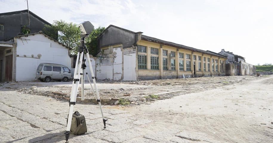
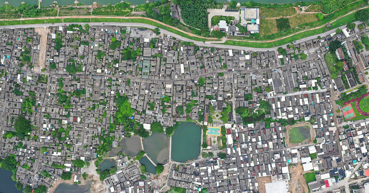
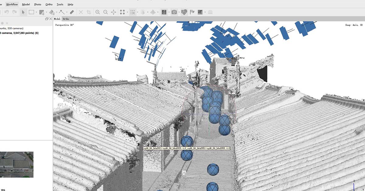
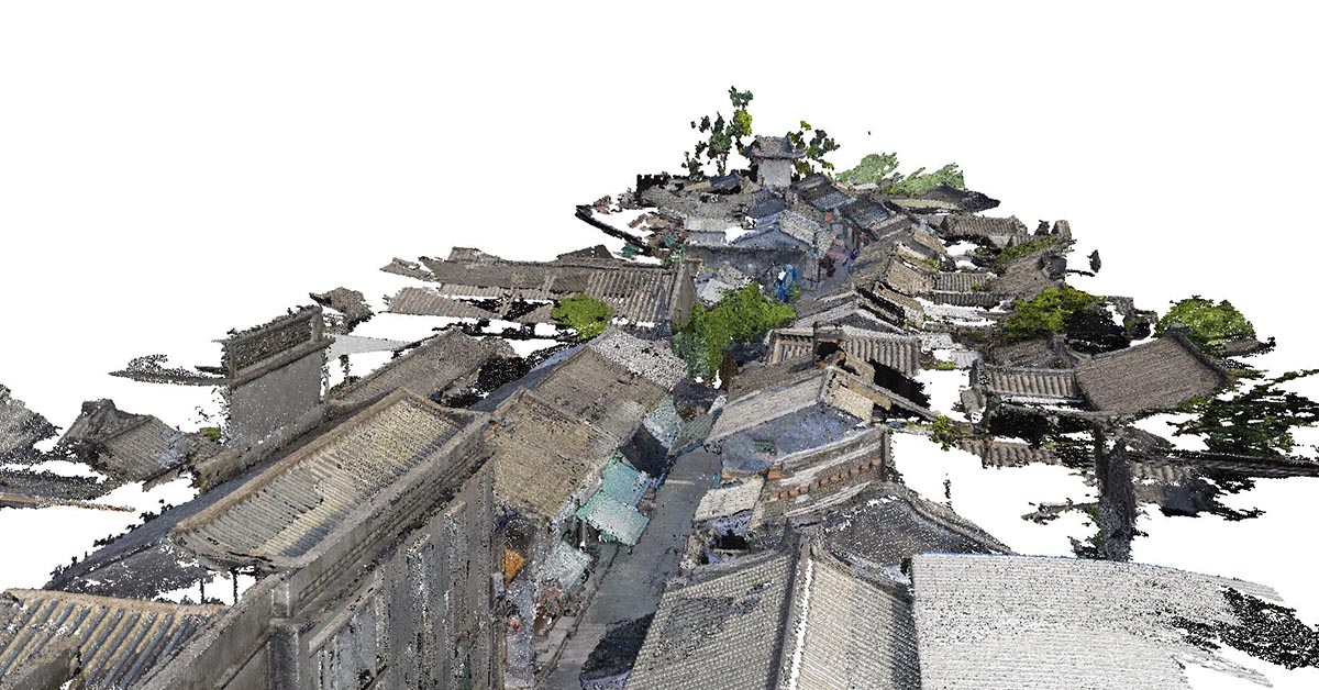
– Region: Long Hu Gu Zhai, Chao Zhou, Guangdong Province, China
– Streets: The total length of all streets covered in this project is 3 KM in total. It includes seven main streets (1.5KM) and three side streets (1.5KM). There are 154 panorama pairs captured by the Civetta.
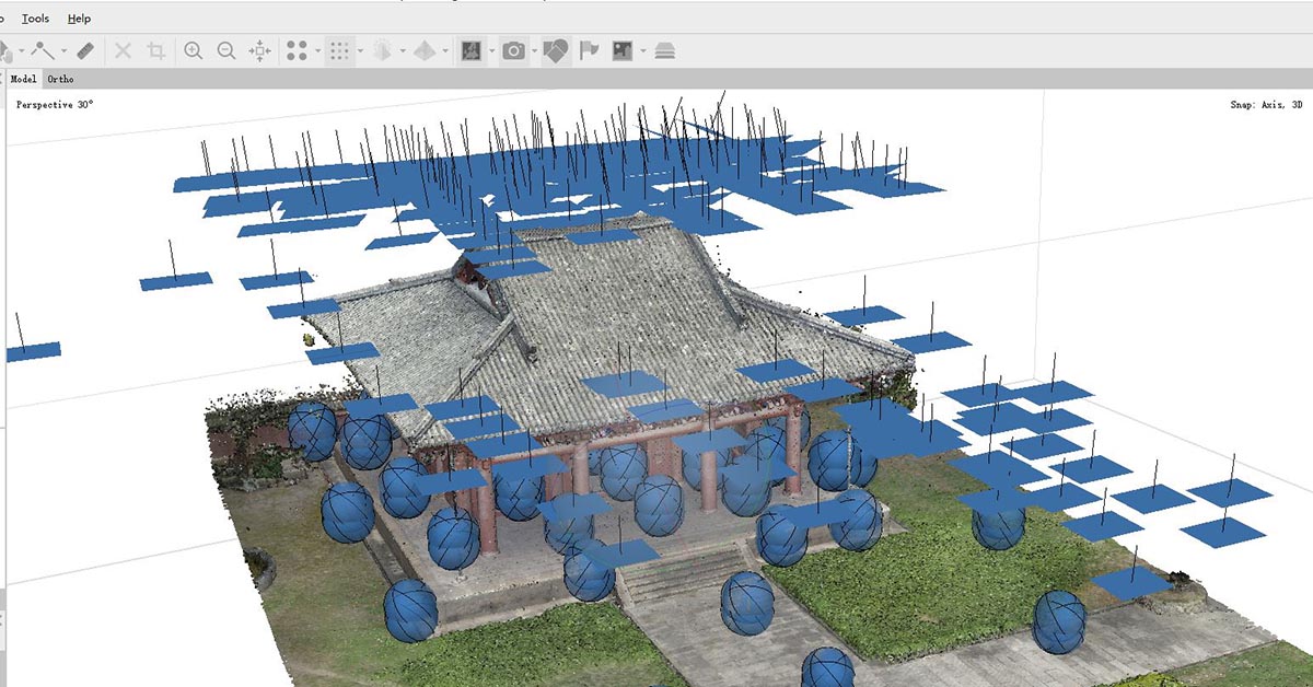
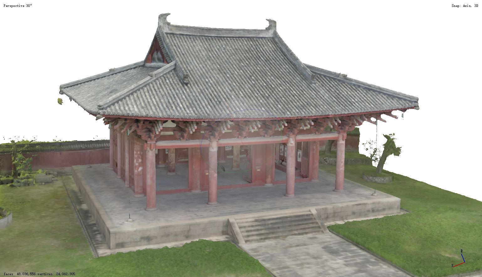
– Building: 1 ancient temple (area covered 45*57m), there are 58 panorama pairs captured by the Civetta.
05. Challenges
– 3D documentation and measurement are difficult as there are passengers, bikes and other factors disrupt the static photo capturing of the scenes.
– Difficulties in capturing the street and building of the area, due to parked vehicles, tables and other objects might block the vision.
– Lighting variance, the region was having high sun exposure with many dark areas in holes and under the roofs
– Drafters can only collect a certain amount of data and dimensions on each trip.
06. Photo capture
With the photogrammetry method, here are a few key points to address if you are considering using panorama images to produce 3D models:
1. The higher the number of photos captured, the more redundancies occur with object point overlaps. Ensure any zone has been captured by the Civetta from at least two spots. Most practical is a capture from an upper and a lower position what can be easily realised with the calibrated measurement tripod that comes with every Civetta.
2. As 360° images cover every direction the registration of 360° one to each other is very fast and accurate.
3. Using the Civetta capturing the full sphere the number of image-captures on-site is heavily reduced. It also minimized the profession and experience required for the staff in the capturing process as it is nearly impossible to forget a view.
07. Hours worked
Some of our clients work alone some work in teams of two whereas one mainly takes care to keep the area clear of people and vehicles.
Field Hours: 3 days capturing for 2 persons to capture ten streets and one building
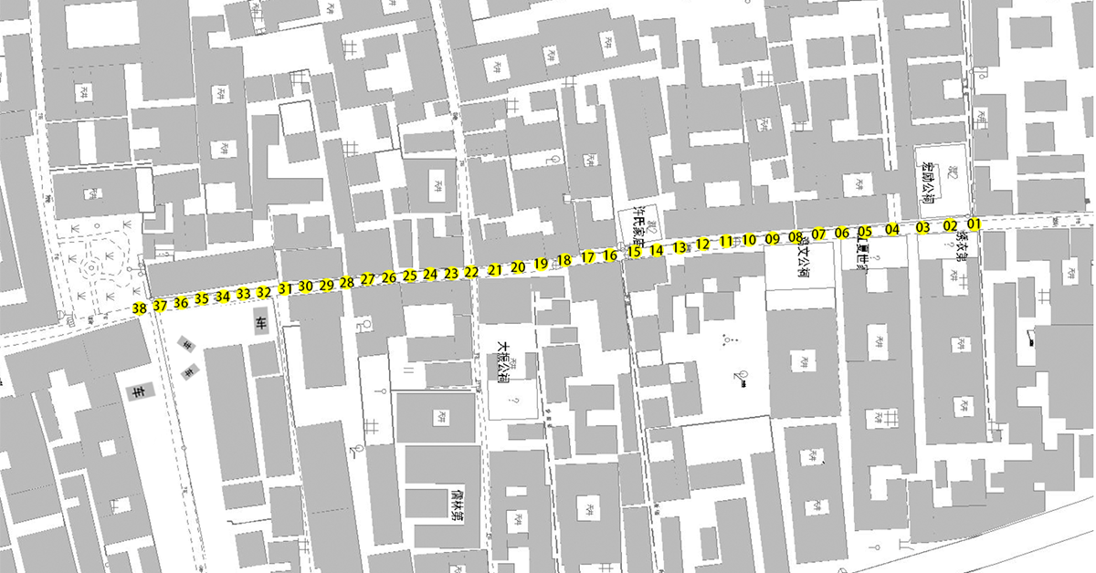
For one street: The staff captured approximate between 17 and 20 image pairs with the Civetta, along with 100 photos captured by the drone to capture the roof topside only. Each street requires approximately one hour to capture all the data.
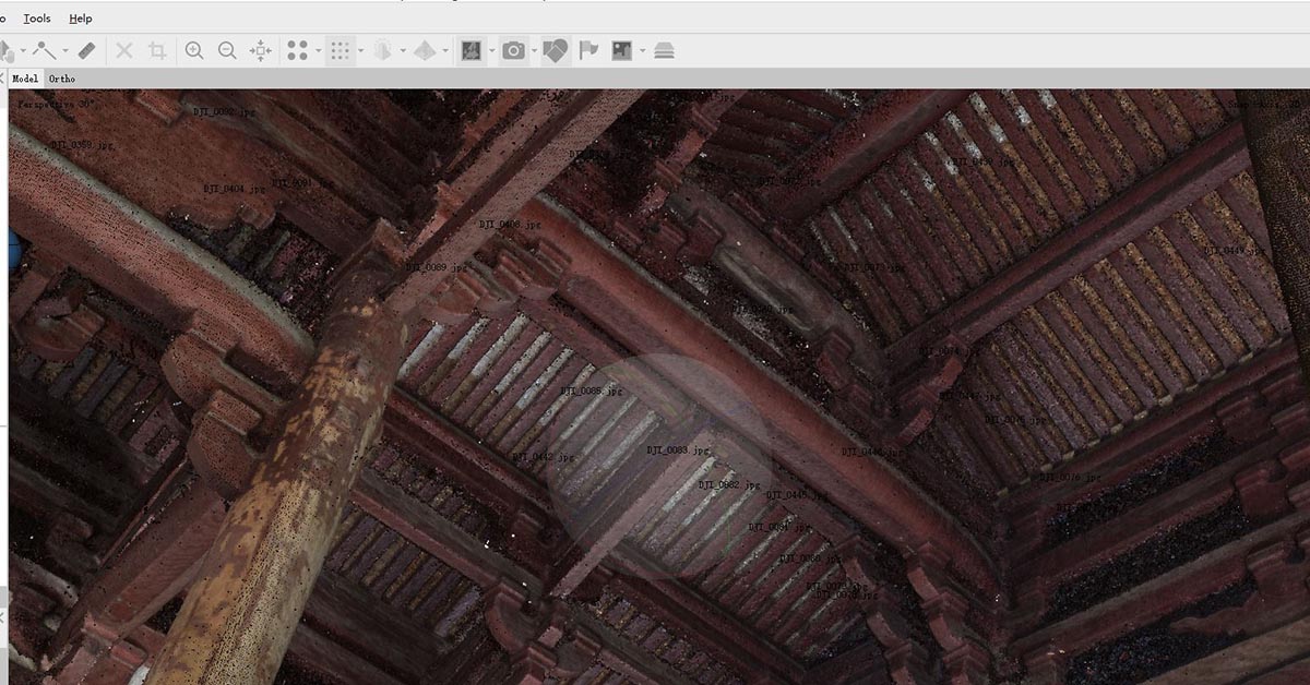
For the ancient temple:The staff captured 58 image pairs with the Civetta, along with 140 photos captured by the drone at the same time to cover the roofsides, not visible from the ground. The entire field work was done in 6 hours.
Office Hours, -download and processing of the 360° images: Back in the office the 212 image pairs were downloaded from the Civetta, and the backup storage. As the Civetta has an internal storage for about 800 captures only one download was necessary on location.
Back in the office the 212 image pairs were downloaded from the Civetta, and the backup storage. As the Civetta has an internal storage for about 800 captures only one download was necessary on location.
Downloading pre-processing and processing are fully automated by utilizing CivettaUtility and does not require human monitoring.
On a Standard PC (e.a.: i7, 16 GB RAM, SSD, USB 3) the download, pre-processing and post-processing steps, are ready in about 90 second per 360° end-result.
For the streets:
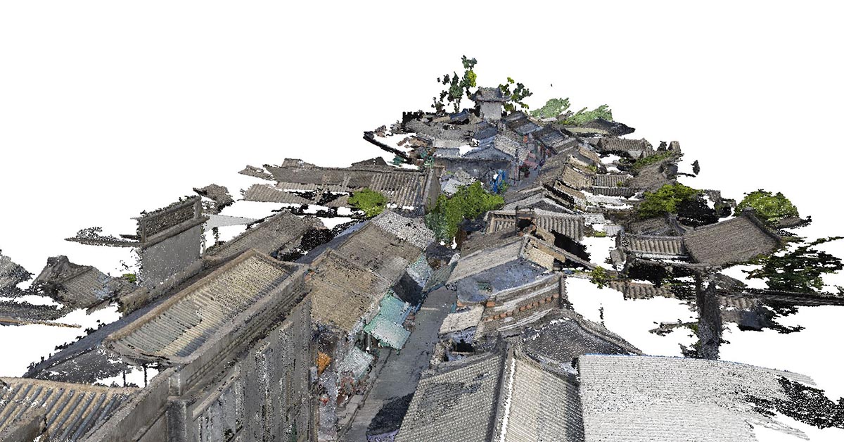
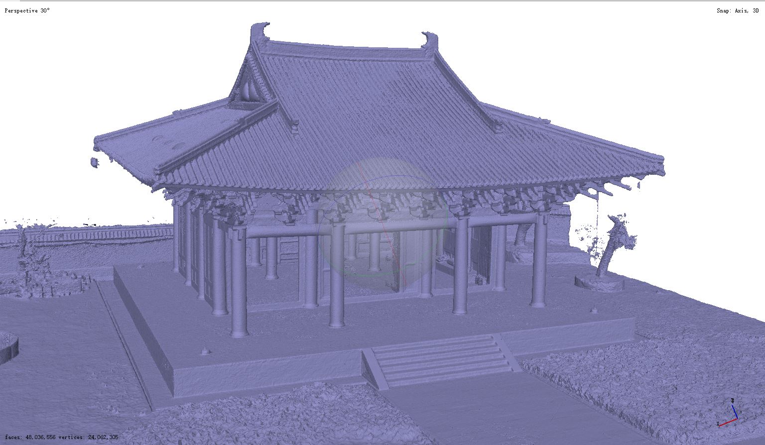
Agisoft Metashape requires 3 hours to process data from each street, with density points as the final output (requested by the clients). The project produced 13 point clouds; each point cloud contains more than 3 hundred millions data points.
For the ancient temple:
Agisoft Metashape requires 8 hours to process its 3D point clouds.
08. General workflow
For the 360 Panoramic Photogrammetry technique, the Civetta was positioned to have the best coverage of the structures. Typically, the distance between each measurement pair is between 5-10 meters. Civetta always acquires HDR images to cover very bright and very dark areas in a scene. The project requires capturing measurable data for 3D models and panorama images, so the panorama images were acquired by the Civetta from the same spot from the upper and lower positions.
The tripod is pre-calibrated to ensure an exact 600 mm distance between upper and lower position. It means you can add measurement values to the point cloud by adding 600 mm in the distance field when processing it with Agisoft Metashape. In addition you can take measurements in the 360° images without further calibration when working with VAM2.
The total time of 212 panorama pairs (with measurement data) captured was around 16 hours, which included setting up the camera, and the automatic capturing process operated by the Civetta itself at each spot. It does not include transportation time and the time waiting for passengers to leave the area. As a photogrammetry method, it requires to secure 60% and more overlap between the panorama images captured from different spots.
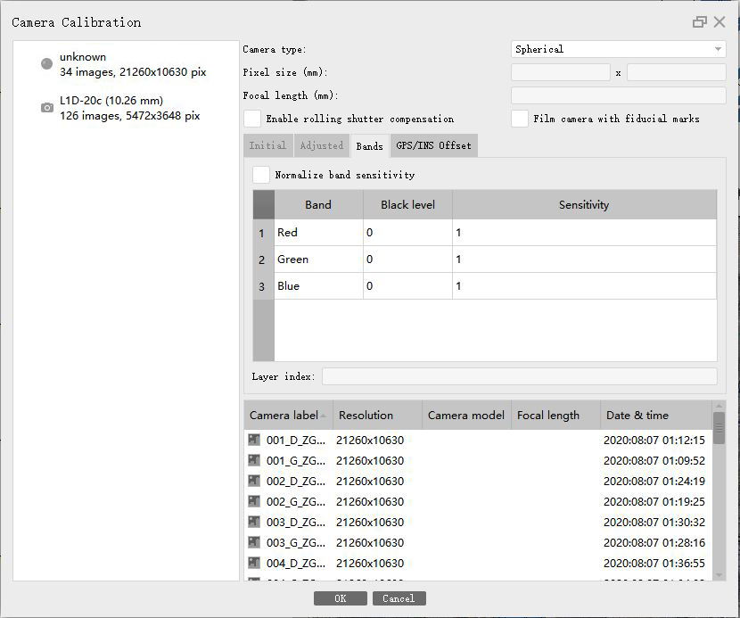
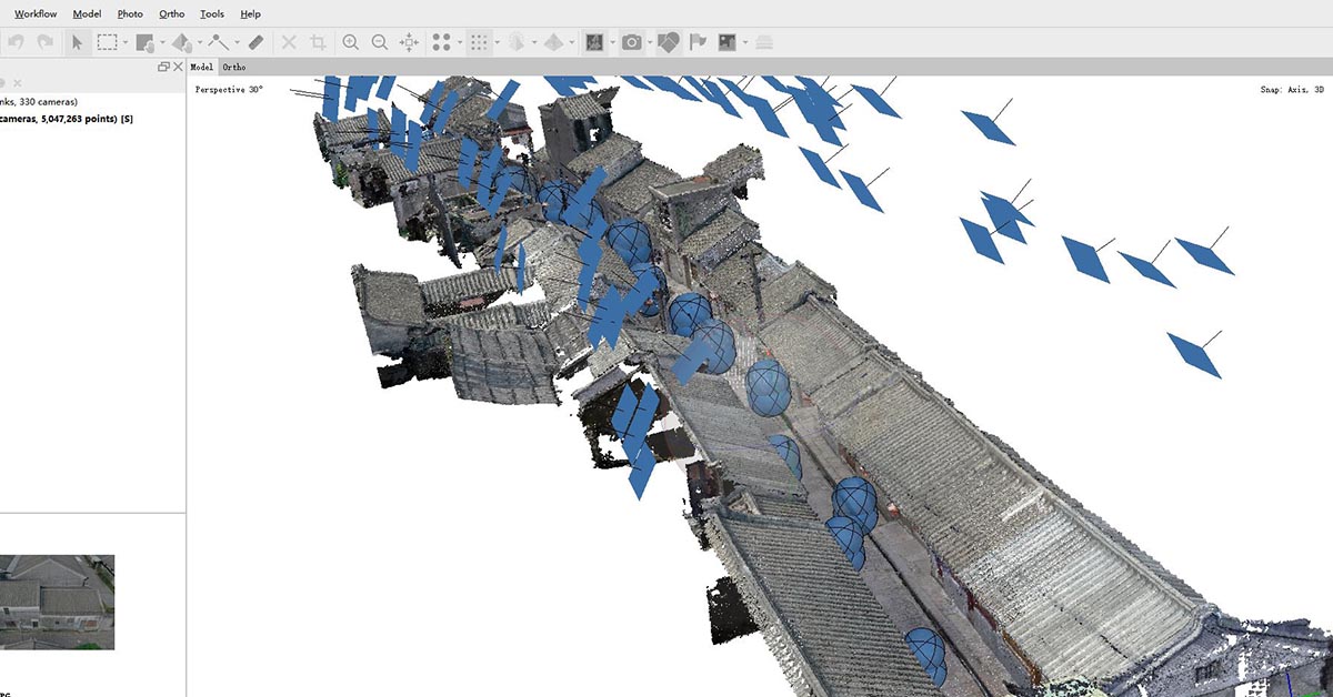
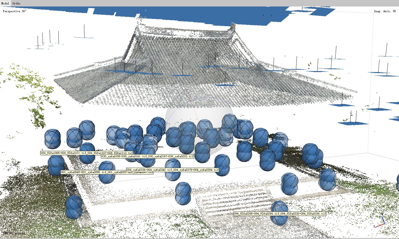
The data processing and registration were conducted using Agisoft Metashape, a high-quality software product for photogrammetric processing of digital images and generating 3D spatial data. Before uploading the photos, users can use the mask function in Metashape to cut out the bottom tripod area of the 360° images. After importing all the panorama images into Agisoft Metashape, users can input the distance values into Agisoft for a pair of panorama images captured on the same spot. Users shall assign proper camera type, a Spherical camera, for the corresponding image groups in the Camera Calibration Dialog of the Tool Menu. It goes through the general workflow of data processing, including aligning photos, building dense point clouds, mesh, texture, tiled model, digital elevation model, and export result. The result can be a sparse point cloud in the viewer with the camera positions’ position estimations indicated as bubbles.
09. Deliverables

10. Conclusion
Civetta has produced accurate colored point clouds with data processed by Agisoft Metashape. In the past 12 years, Weiss AG’s Civetta has been used by a wide range of professionals across different industries, including but not limited to Oil & Gas, Aviation, Cultural Heritage, Factory Planning/Maintenance/Re-production, as well as those in the Museum & Galleries, Gaming, and Movie industries. Within only one button on the hardware’s body, it is easy to use with almost no prerequisites on the person who uses it.
The combination of Agisoft Metashape and Civetta can help you with:
● Detailed documentation with fast scanning time
● Quality point cloud data and panorama images for reconstruction, rendering, and modeling
● A full pack of assets for digital management, maintenance, and virtual training
11. Acknowledgment
Weiss AG has been in the field of photogrammetry for more than 12 years; ever since then, Weiss AG and its users have been a group of users of the Agisoft Metashape Software to produce stunning results for a variety of purposes in their professional sectors. We sincerely appreciated Agisoft Metashape for supporting panorama images in 3D model construction, and for providing essential support and guidance for this study.
Author: Christiane Zhao, Marketing Specialist
Date: 11th January 2021