A Case Study
Tunnel Monitoring and Measurement
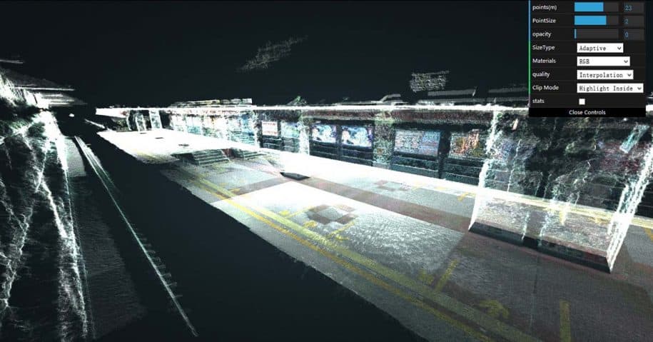
With the increasing number of tunnels built around the world, the monitoring, detection, maintenance and renovation of these tunnels are increasingly important. Tunnel projects are typically huge investments. They often have a long route mileage and involve strong concealment, factors which impose heightened quality requirements on the construction and maintenance during operation. Highly accurate 3D scanning is quickly becoming the main way to document and visualize the in-progress build condition of urban tunnel projects.

Weiss AG, a European company of experts with more than 10 years experiences in 3D scanning, provides 3D scanning and digital asset management (DAM) services to support construction groups working in tunnel design and maintenance. The use of Civetta, a 360-degree camera by Weiss AG, can generate a set of panoramic HDR images to produce a 3D model. These 3D scanners allow the user to take measurements while extracting 3D coordinates and geo-reference information in relation to each panoramic picture. With the Visual Asset Management System provided by Weiss AG, the construction and management teams can establish visual connections between multimedia files, thus enabling better communication and documentation throughout the project.
Background
Weiss AG’s reseller, Guangzhou MG Data Tech Ltd, helped the Beijing Metro Group to provide on-site terrestrial scanning services for site surveys and inspections. The initial challenge of the Beijing Metro Project was to detect issues within the water percolation of the metro tunnel in central Beijing. The main goal of this scanning project was to provide accurate as-built documentation to help engineers and architects determine precise measurements on or off-site, make structural assessments and ensure the highest standards of safety.
3D Scanner and Scanning Services
3D scanning provides a more accurate and simpler way to understand and explain the status and progress of tunnel projects. For documenting as-built conditions, the density of point clouds, meaning the density of points of reference within the environment for the program to utilize, must be high enough to produce CAD drawings, 3D mesh models and panoramic point cloud pictures. A high solution scanner is needed in underground construction such as tunnel projects. As the Beijing metro tunnel needs to detect water percolation, the scanner must have an accuracy within 0.03 mm to identify crevices in the tunnel.
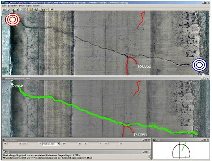
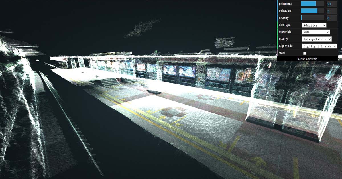
Civetta is preferable to use as it provides time-efficient and accurate equipment allowing the capture of high-quality images with the press of a single button. The Civetta is a fully automated 360-degree camera that can create 32-bit HDR images. Civetta takes a mere 40 seconds to record an entire spherical image, capturing all the varying light within the scene. With an impressive accuracy of +- 2mm within a 10m distance, users can take precise measurements from the captured images via the Visual Asset Management (VAM2) platform.
Terrestrial scanning saves hundreds of hours on planning time and prevents misspent labor. This detailed and accurate information can help the company save time and money, avoid mistakes and increase transparency between different departments in maintaining, repairing and upgrading the facility.
Processing Image-Based 3D Scan Point Clouds
After performing a 360-degree panoramic scan, the raw point cloud must be processed. CivettaProcessing was selected as the software for processing the point-cloud data, as it is a compilation software that pairs up with the Civetta camera provided by Weiss AG. It avoids compatibility problems between the software and equipment and avoid the cost of purchasing software since it is part of the package when purchasing Civetta.
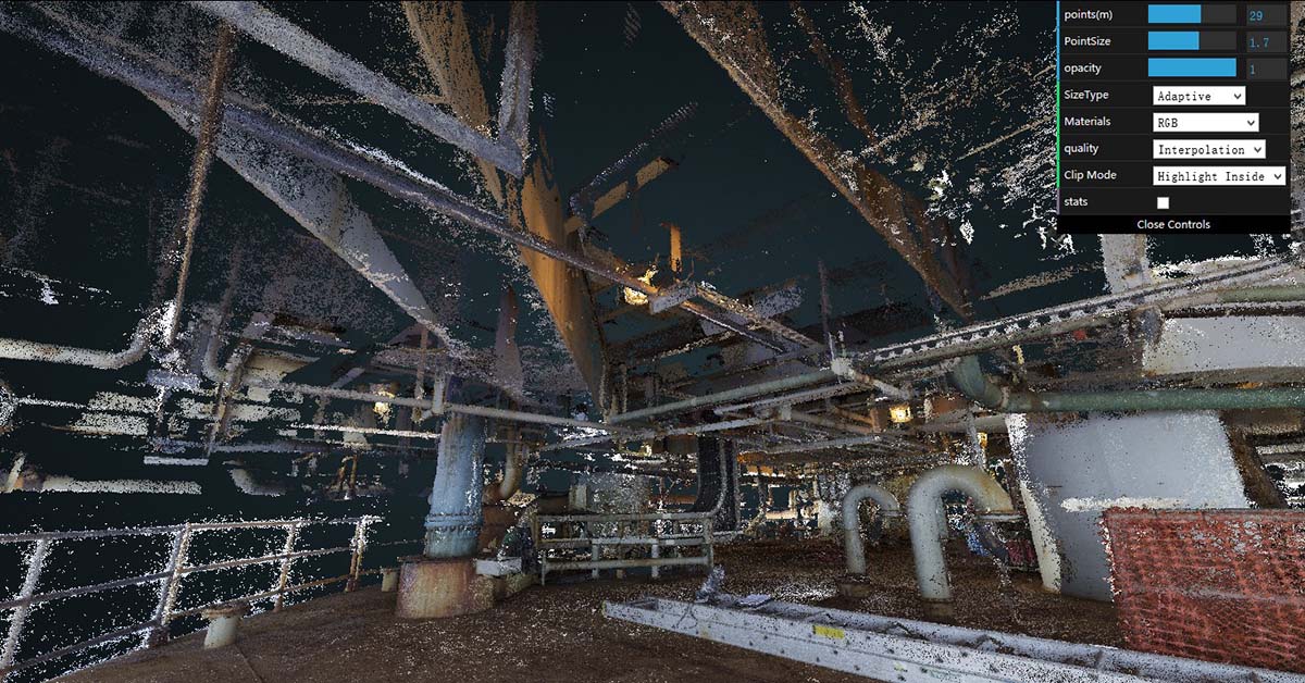
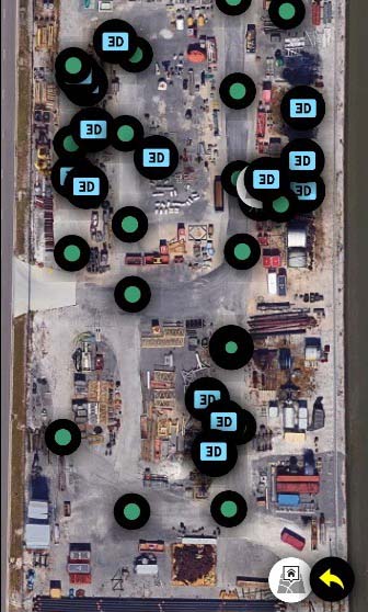
CivettaProcessing supports the automatic alignment of overlapping areas of point clouds to .esr and .jpg files, as well as the use of targets to geo-reference scan data. More than five hundred scans were registered together to generate one complete model space to establish a 3D mesh model, This space was based on hundreds of sets of panoramic point cloud pictures. The HDR images taken by the Civetta includes real 3D coordinates and accurate measurement distances, so it is achievable for engineers to extract this information to use in any other system. Users can also generate the measurement details through a few clicks or connect digital files with URLs in VAM2.
The Use of Visual Asset Management Platforms to View, Edit, Manage and Share Project Assets
Good as-built documentation has the potential to be very valuable to the owners and operators of infrastructure facilities and to all stakeholders in large infrastructure projects. The as-built documentation is obtained soon after project completion, or is updated during construction, and when the documentation includes a high standard of accuracy, it has a greater number of uses in the operations phase of large facilities.
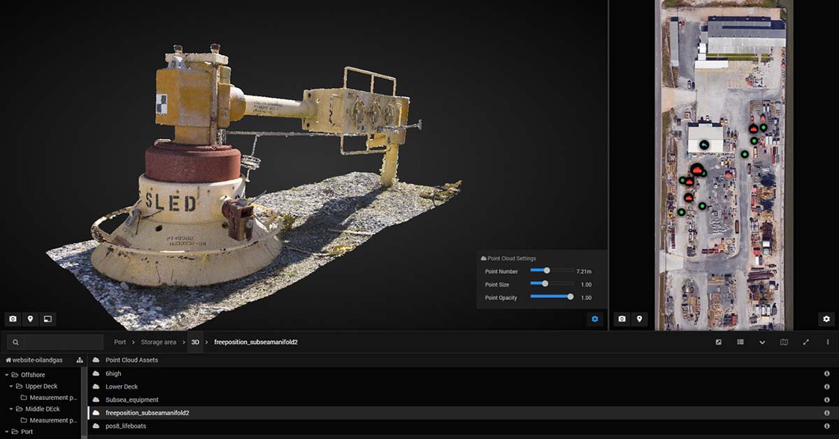
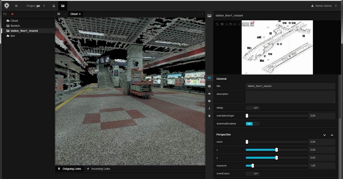
With the VAM2 innovated by the Weiss AG team, it enables client groups to generate and manage digital assets throughout the tunnel construction process through tools such as point cloud collection, section deformation analysis, dislocation analysis, tunnel and track image generation, roaming video generation and other essential tunnel-related documentation.
VAM2 is completed based on cloud technology, and all data types can be accessed via a single web browser. It includes, but is not limited to 3D models, documents, CAD data, panoramic pictures, 360 videos, audio, geo-reference, maps and much more. By establishing the links between the 3D model and other files via URLs, viewers can establish a more comprehensive and realistic understanding of the construction environment, together with the amount and quality of contributions by each team or individual member.
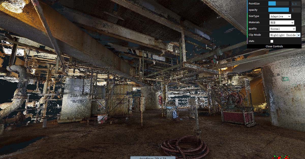
For some construction data that is sensitive and should not be available to the public, the team can either set authorisation restrictions on the cloud, or directly request a private package to be sent. Invitation codes or passwords can be created to secure the information on the cloud. The final product was a simple URL that could be opened and shared with other authorized project participants anywhere and at any time.

Generally, it is difficult for people without engineering background to understand the information involved in surveying reports, drawings, and engineering data. For the interest of transparency, public agencies that commission construction projects must make project information available to the government officials and to the general public. It is important to know that VAM2 does not have minimum computer system requirements, nor does it require users to have any technical skills or knowledge. VAM2 can be integrated into the traditional workflow for legal entities, and can also accelerate clear work distribution between departments or groups. Therefore, VAM2 has been used by several government agencies and legal entities across the world for the purposes of documentation and management.
Author: Christiane Zhao
